Archive maps and mapping
in the studio with Layla Curtis
Clare Qualmann
Visiting Layla Curtis’ East London studio, you can’t help but be quietly in awe. The space is neat and ordered, whilst simultaneously full of stuff. Framed drawings are stacked against the wall. Metal racking, shelves, and plan chest drawers edge the room. Three large work surfaces are spread with beautifully aligned papers; maps, drawings, paper, tools and other materials. At the desk by the window a stack of books speaks to her long-standing research interests; I spot Nan Shepherd’s Living Mountain, Tina Richardson’s Walking Inside Out, and Guy Shrubsole’s Who Owns England? On the walls are a few earlier works, a small map collage from Curtis’ famous series of hybrid maps.
I’ve come to see a collection of map materials that have just come into her possession. They are from a publishing company’s recently dissolved map archive/library - an extraordinary sounding space stacked with maps, charts, and atlases from all over the world and covering every conceivable detail of the earth, moon and stars. Curtis tells me about her first visit, and how she completely underestimated the scale of what was on offer, and how long it might take her to look through and select materials that she would like to work with.
The archive was in Glasgow, Scotland, so traveling back and forth was not so easy from her London base. When she first arrived materials had already been claimed; some by museum and gallery collectors, others by members of staff from the publishing house so right from the start she asked herself ‘what have I missed?’ She talks too about questions of value and how different parties had different perceptions of this. Beyond the ‘important’ and ‘historic’ there are many very beautiful graphic artefacts that would be easy to sell on - but Curtis’ approach is different.
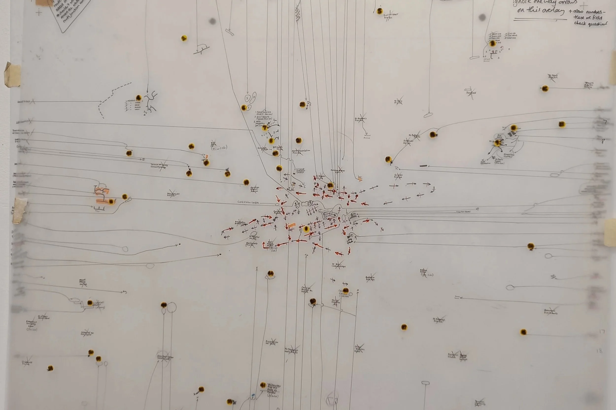
Archive map showing annotations for road junctions, collection of Layla Curtis
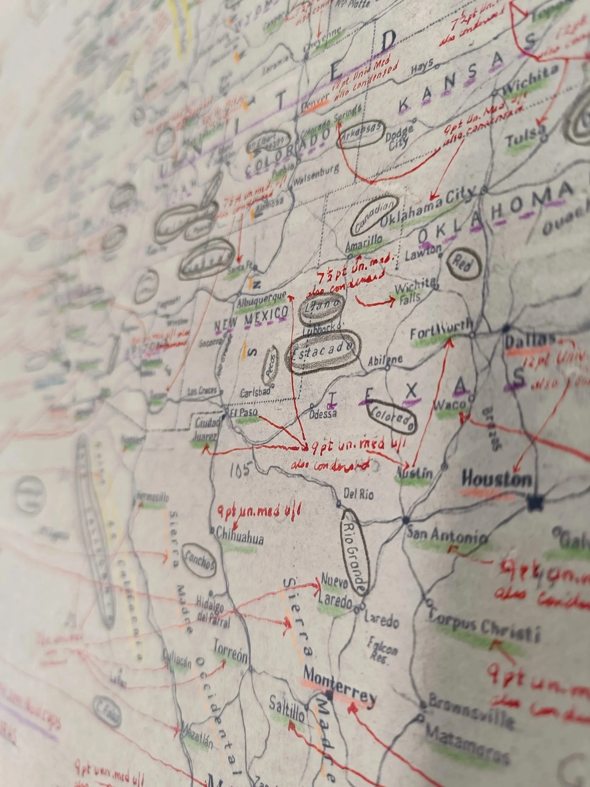
First, to the surprise of the people organising her visit, she got ‘stuck’ in the discard pile; the heap of papers that were stacked outside of the library already earmarked as worthless and ready for disposal. In this heap, as she shows me, were an extraordinary collection of map ‘amends’, the overlays for all kinds of maps that are being updated. They show the working methods of the people checking and logging; new road junctions and new housing developments, name changes, and newly classified streets. Many of these come from the A-Z archive, the famous map publisher, that was taken over by this group in 2019.
The resonance with Curtis’ work is so direct, it’s extraordinary. One of the ‘amend’ drawings on translucent film is taped to the studio wall, just above a framed drawing by Curtis in which the names of streets alone are mapped, creating a ghost of the road layouts that they correspond with. We discuss how this connection comes at a point in her career when she has developed such an extensive body of work around maps, and she notes that she’s glad that her processes have evolved without meeting these professional cartographic methods in such detail (before this point). The parallels in practice might have been too much, overwhelming her creative and spontaneous exploration of materials, imagery, process and form. But now, 25 years in, it’s a perfect moment to encounter these contexts and interconnections.
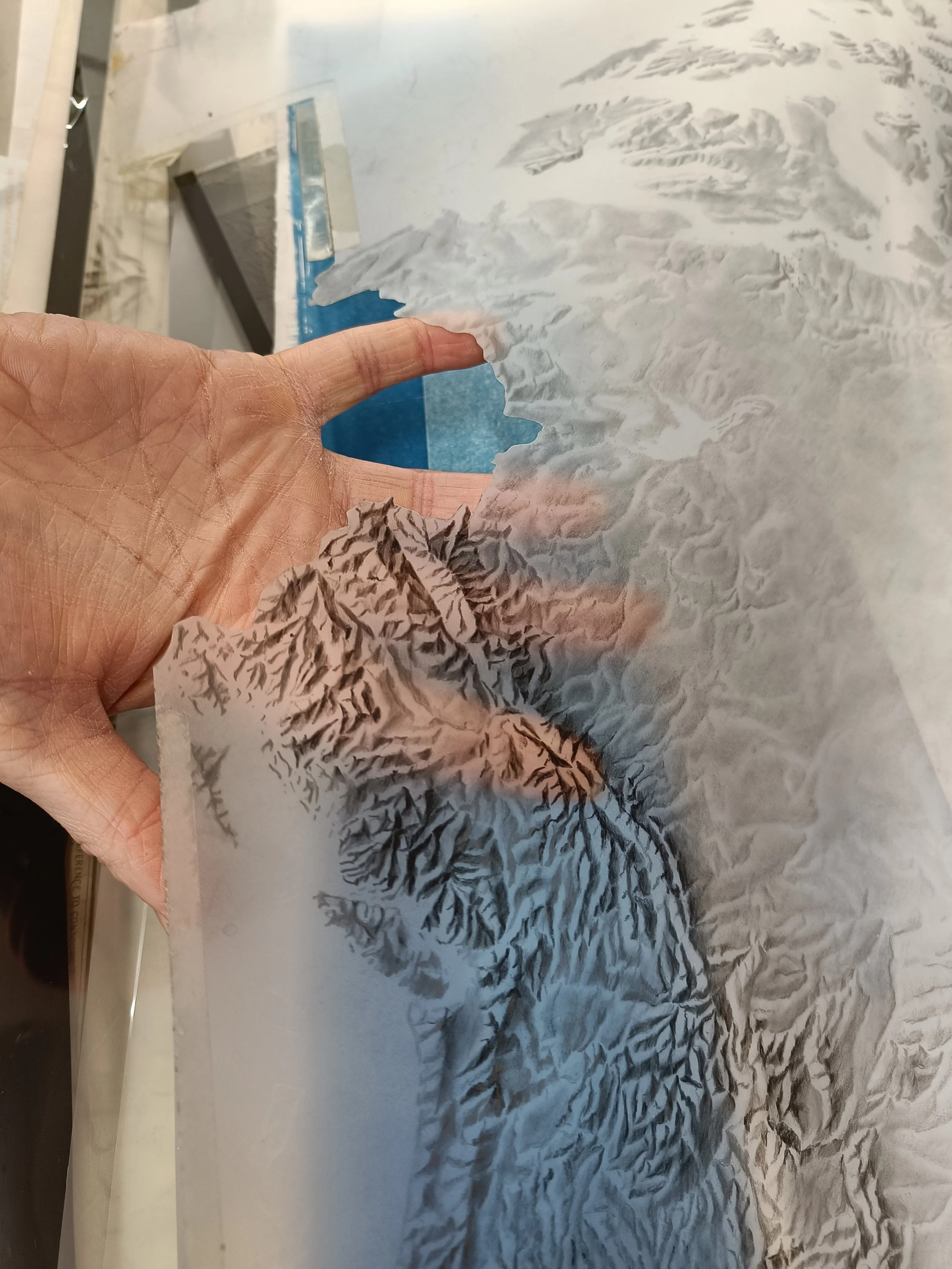
Archive map layer with hand cut edge - topographies, collection of Layla Curtis
Cyanotype prints are some of the first experiments that are emerging in response to this newly acquired archive. Using panels from a large scale atlas Curtis is printing the elevation layers of each continent. The architectural film originals are hand-drawn in pencil (from the archive) with cut out edges to join up between continents. The deep deep blue of the cyanotype conjures up imagery of the earth from space. The intensity of the colour, and the watery artefacts that the process leaves on the paper combine to make striking images. The test prints have subtle variation in tone - the precise paper stock is yet to be decided - but the printing process that cyanotype offers captures in brilliant detail the edges, the tape, and the annotations on the originals that are so important to the narrative of the resulting works.
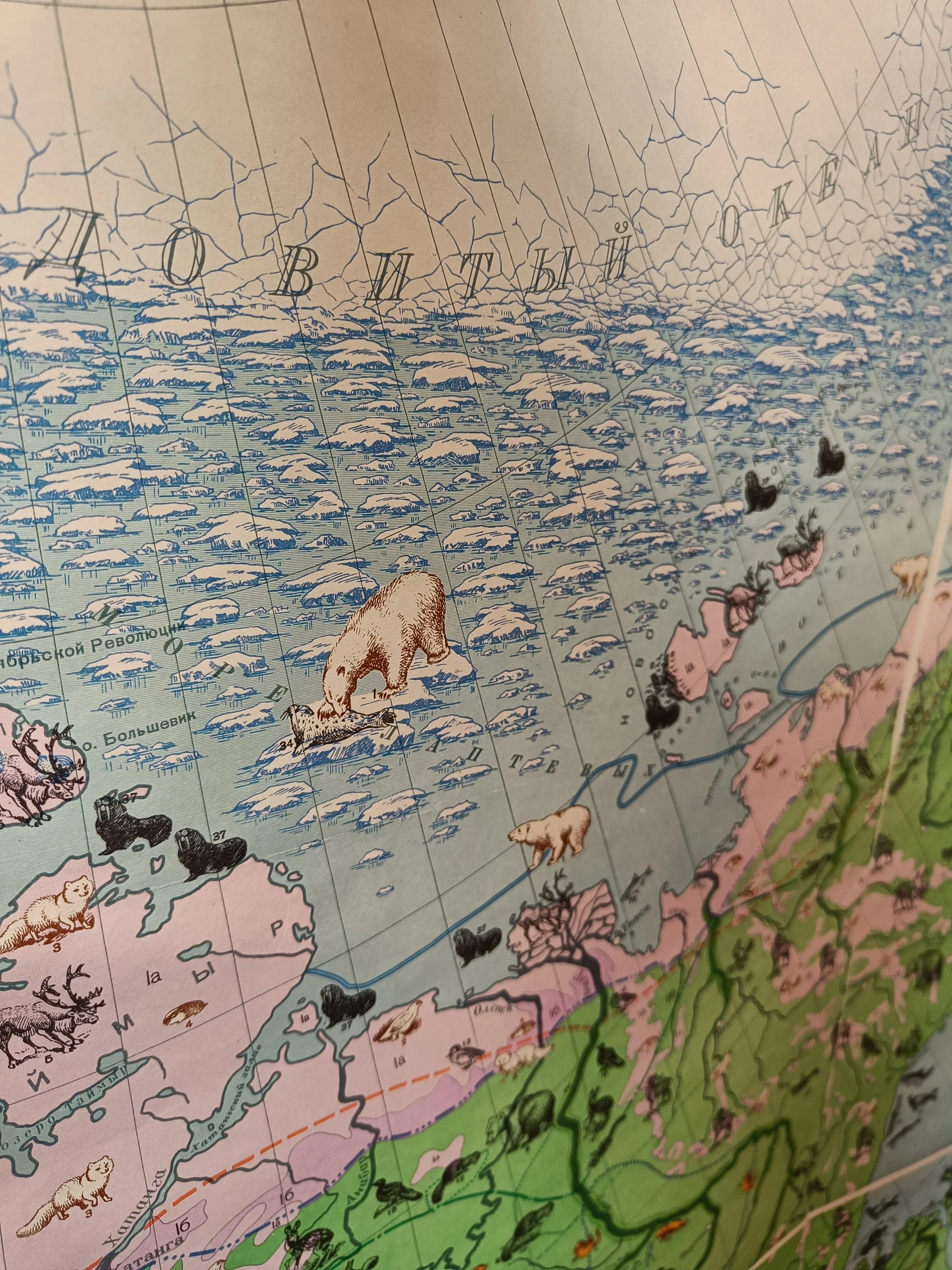
Archive illustrated atlas page with fauna illustrations of the arctic, collection of Layla Curtis
We come back to the decision making process that she had in acquiring the materials. Under pressure, and with limits to how much she could transport (and store in her London studio) she had to make quick decisions and follow her gut feelings. She was drawn to places that she has visited; she took everything they had on Antarctica, for example, where she spent three months on an artist expedition in 2005. Other items grabbed her attention because of their graphics, the appeal of the colours, the forms, or the reveal of the process behind the work. There are many print maps in her new collection, but also colour separations, the annotated amendment sheets and overlays, print plates and other working documents that tell stories of the processes of pre-digital map making.
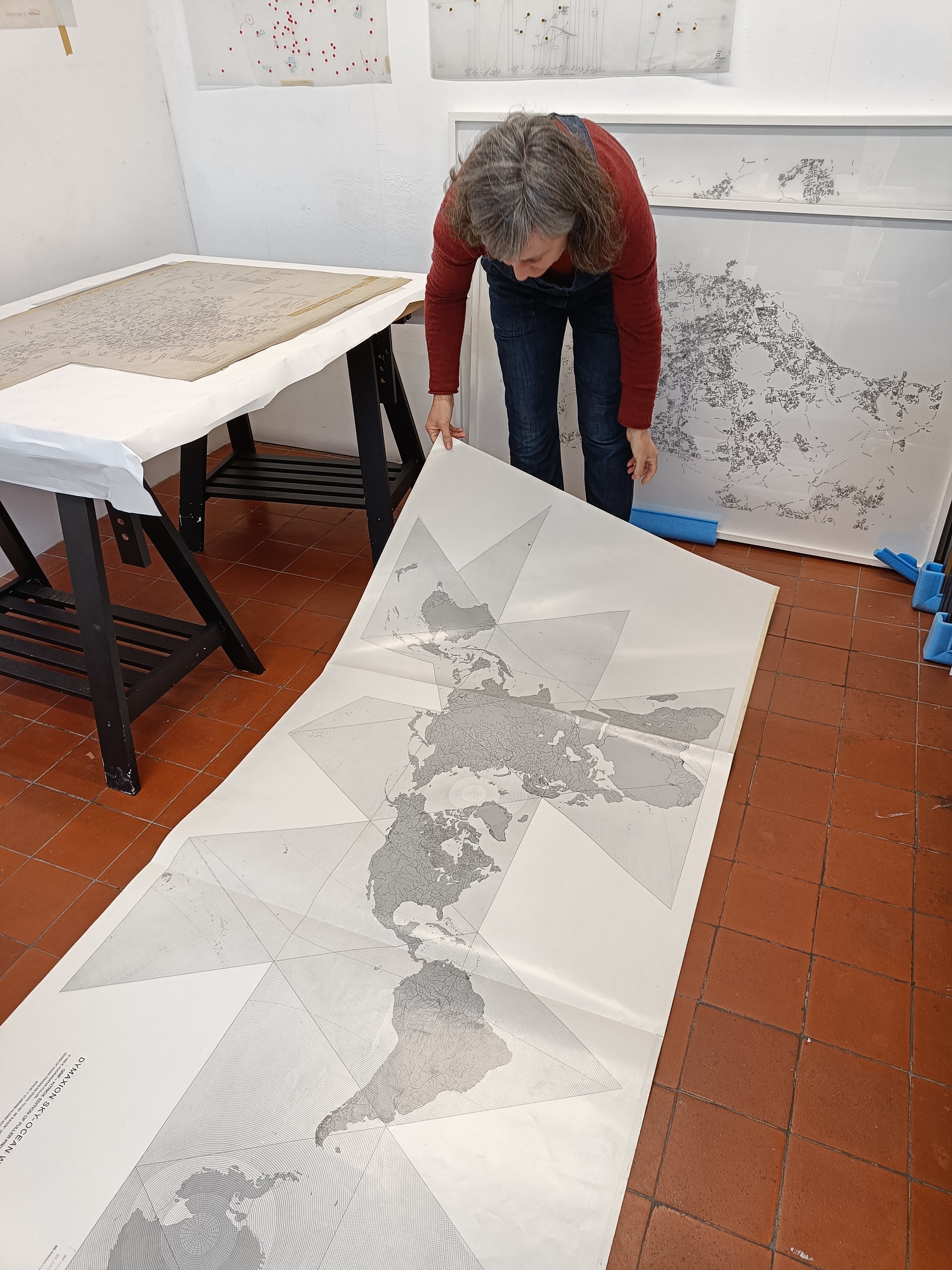
Layla Curtis in her studio with a dymaxion projection map of earth
Looking through the huge plan chest drawers together, Curtis highlights some of the treasures; a map-layer of the US and Canada in which the fonts for places names are being determined, a Russian map of animals with the most beautiful graphic illustrations, and an enormous dymaxion projection map that we unfold on the studio floor to marvel at. This example connects in with another set of experiments laid out on the work surface in the studio; a small set of drawings and corresponding cyanotypes that explore the different ways that the Earth, a sphere, can be represented in two dimensions. Curtis describes the creative connection that she feels cyanotype makes to the maps, it’s low-tech, but you can print it more than once, the works can be reproduced and distributed, like the maps they stem from.
Archive map showing place name font decision annotations for the United States of America, collection of Layla Curtis
I can’t help but wonder if this new mass of material will pull her in new directions, halting previous work streams and instigating new routes, but Curtis insists that she’s going slowly, dipping in and out. There’s so much material it’s still being sorted and sifted and slowly categorised and stored safely. The first experiments are just that - tests and trials. She describes the new collection as a fragment of an archive, and her role now is to intervene in it, to find new ways to make it visible beyond people rummaging through paper in drawers.
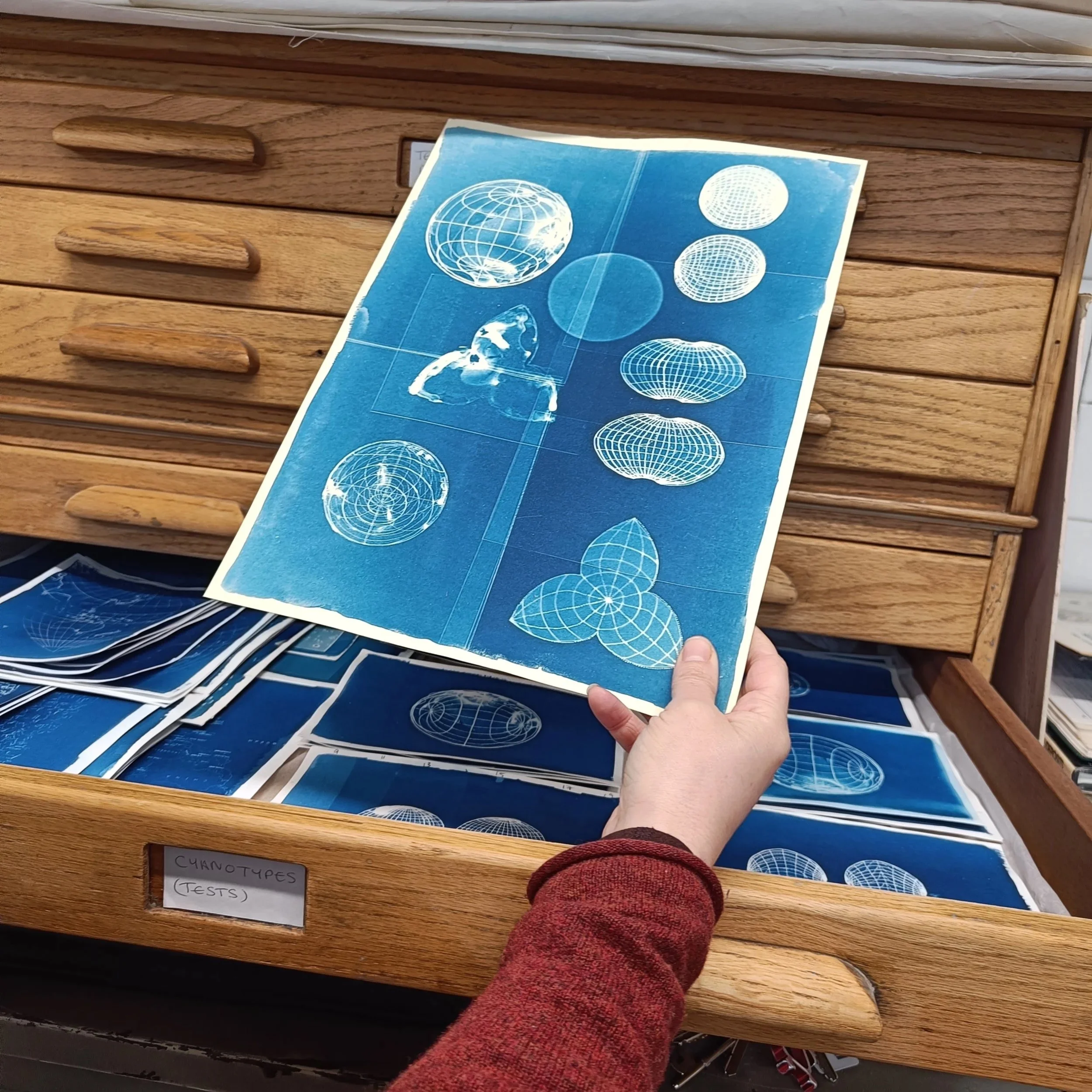
Cyanotype test prints by Layla Curtis
In the same week of my visit to Curtis’ studio I also attended Tim Waterman’s inaugural professorial lecture at UCL which focused on the concept of Planetarity.
Planetarity recognises that we are not separate from nature and that the interconnectedness of all things stretches both across and beyond the planetary limits of Earth. Planetarity demands thinking that is beyond human boundaries and bordering, moving between the big picture (the famous image of Earth as a blue ‘marble’ seen from space) and the lived reality of interactions on and with the ground. Waterman calls it an ‘umbrella concept’ pulling together ideas of the Earth, the World and the Globe, as well as the wider cosmos.
In Curtis’ work, her interventions with and reappropriations of maps bring to life the labour, the processes, and the materiality of map-making in rapidly changing times. Making visible the means of representation; from stars to fauna, place names to ocean ridges, road junctions to ice shelves she conjures up both the actual places that they speak of, and the human systems of bordering, classification and control that they are subject to. They draw the viewer in with a breathtaking aesthetic underpinned by deep interconnections that speak of the meanings of place, the structuring of knowledge, of naming, of identity, borders and belonging; the politics and poetics of maps. If Planetarity stems from an urgent need to reimagine (and recreate) our world(s) perhaps these maps are a tool for radical imaginings to support us on our way?
IG @laylacurtis